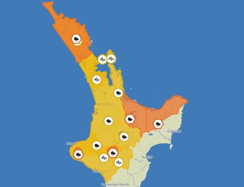
Heavy rain warning: Orange

Heavy Rain warning- Bay of Plenty west of Rotorua

There has been a slight reduction in the forecast to 80mm to 110mm (80mm to 120mm this morning), and an increase in the period which is now ending at 04:00am Tuesday.

Situation

A frontal system over the north Tasman Sea is expected to move over northern New Zealand during Monday. A period of heavy rain is expected in the north of the North Island, and about the western Tasman District. Additionally, northeast winds are expected to reach gale for a time in Northland. Warnings and Watches are in force. People are advised to keep up to date with the latest forecasts.


Heavy Rain Warning - Orange

Area: Bay of Plenty about and west of Rotorua

Period: 16hrs from 12:00pm Mon to 4:00am Tue

Forecast: Expect 80 to 110 mm of rain inland, and 50 to 80 mm of rain about the coast. Peak rates of 15 to 25 mm/h expected.
Minimal chance of upgrading to a Red Warning.

Impact: Streams and rivers may rise rapidly. Surface flooding, slips, and difficult driving conditions possible.

Action: Clear your drains and gutters to prepare for heavy rain. Avoid low-lying areas and drive cautiously.

Heavy rain warning from Monday- Orange

MetService New Zealand has issued a heavy rain warning for Bay of Plenty from around lunchtime Monday. At this stage they don't think it will be upgraded to a red warning.

Heavy Rain Warning - Orange
Area: Bay of Plenty about and west of Rotorua
Period: 14hrs from 12:00pm Mon to 2:00am Tue
Forecast: Expect 80 to 120 mm of rain. Peak rates of 15 to 25 mm/h expected.
Minimal chance of upgrading to a Red Warning.
Impact: Streams and rivers may rise rapidly. Surface flooding, slips, and difficult driving conditions possible.
Action: Clear your drains and gutters to prepare for heavy rain. Avoid low-lying areas and drive cautiously.

Heavy Rain Warning - Orange issued for Bay of Plenty east of Kawerau

Heavy Rain Warning - Orange issued Bay of Plenty east of Kawerau Period: 15hrs from 9:00am Sun to 12:00am Mon Forecast: Expect 80 to 120 mm of rain. Peak rates of 15 to 25 mm/h, especially in thunderstorms and possible downpours. Low chance of upgrading to a Red Warning.

Impact: Streams and rivers may rise rapidly. Surface flooding, slips, and difficult driving conditions possible.

Action: Clear your drains and gutters to prepare for heavy rain. Avoid low-lying areas and drive cautiously.

Severe Thunderstorm Watch for Bay of Plenty and Rotorua

An unstable northwest airflow lies over the northern North Island. There is a moderate risk of thunderstorms about Bay of Plenty and Rotorua early Monday morning.

Whether these thunderstorms occur or not, there is a chance of localised downpours of 25 to 40 mm per hour. Conditions are likely to ease in the west earlier than the east.


Rainfall of this intensity can cause surface and/or flash flooding, especially about low-lying areas such as streams, rivers or narrow valleys, and may also lead to slips.


Driving conditions will also be hazardous with surface flooding and poor visibility in heavy rain.


Note: A Severe Thunderstorm Watch means conditions are favourable for severe thunderstorms in and close to the watch area. People in these areas should be on the lookout for threatening weather conditions and monitor for possible Severe Thunderstorm Warnings.

For full details, check out MetService: www.metservice.com/warnings/home


Heavy Rain Warning (Orange) Extended

Heavy Rain Warning – Orange – Bay of Plenty and Rotorua • Warning extended to 12am Saturday • Further rain to accumulate • Possible localised downpours and thunderstorms • Minimal chance of upgrading to red warning

MetService Severe Weather Warnings for Bay Of Plenty and Rotorua


Situation

A front preceded by a moist northerly flow is expected to move slowly east across New Zealand today bringing rain to much of the country. The heaviest rain is likely to affect the north of the North Island, and the north of the South Island. Localised downpours and thunderstorms are also possible for northern regions of the North Island. Watches for heavy rain are in force, and Rain Warnings for Bay of Plenty including Rotorua, and the Tasman District. People are advised to keep up to date with the latest forecasts.


Heavy Rain Warning - Orange

Area: Bay of Plenty and Rotorua

Period: 15hrs from 9:00am Fri to 12:00am Sat

Forecast: Expect another 60 to 90 mm of rain to accumulate on top of what has already fallen. Peak rates of 15 to 25 mm/h, but rates of 25 to 35 mm/h possible in localised downpours and thunderstorms.
Minimal chance of upgrading to a Red Warning.

Impact: Streams and rivers may rise rapidly. Surface flooding, slips, and difficult driving conditions possible.

Action: Clear your drains and gutters to prepare for heavy rain. Avoid low-lying areas and drive cautiously.

Heavy Rain Warning- Orange

Heavy Rain Warning - Orange Period: 15hrs from 9am - 12am Sunday 23 June 2024 Area: Bay of Plenty east of Kawerau and Rotorua

Expect 80 to 120 mm of rain. Peak rates of 15 to 25 mm/h, especially in thunderstorms and possible downpours.
Low chance of upgrading to a Red Warning
Impact: Streams and rivers may rise rapidly. Surface flooding, slips, and difficult driving conditions possible.
Action: Clear your drains and gutters to prepare for heavy rain. Avoid low-lying areas and drive cautiously.